
Map of Jupiter
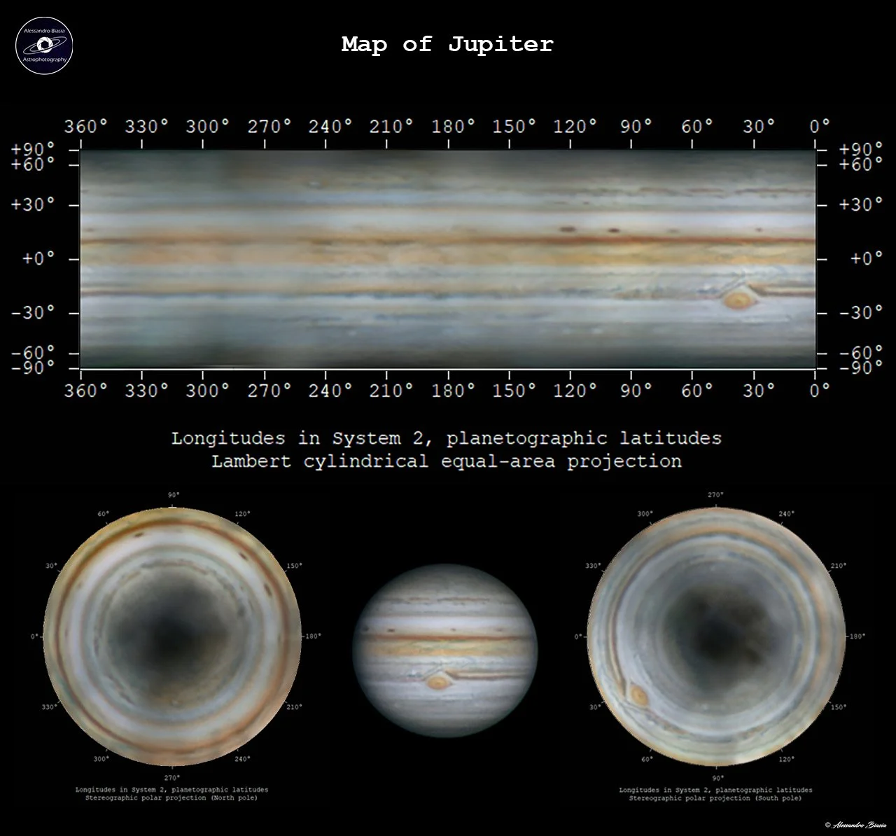
Image Description and Details : If you have photographs of a planet that cover all 360 °, it is possible to create a map of the planet using the Winjupos software.
In this case, I have completely mapped the planet Jupiter.
At the bottom left is a polar projection from the North Pole, and at the bottom right a polar projection from the South Pole.
The largest storm in the Solar System stands out: the Great Red Spot (or GMR).
Acquisition data:
Sky-Watcher Newton 200/1000 BD
HEQ5 Pro SynScan
ZWO ASI178 MM
Barlow 2,7x APM
R-G-B filters Meade
Copyright: Alessandro Biasia
Share & Credit This AAPOD2 Feature
When you share this image on AstroBin, social media, forums, or your own website, please include a credit to AAPOD2 so viewers can discover where this feature came from.
Support AAPOD2 for free! Use Our AGENA ASTRO Affliate Link
AAPOD2 Title: Map of Jupiter
AAPOD2 Page Link: https://www.aapod2.com/blog/Map-of-Jupiter
Submit Your Photo!