
Mapping the Lunar South Pole and Shackleton Crater
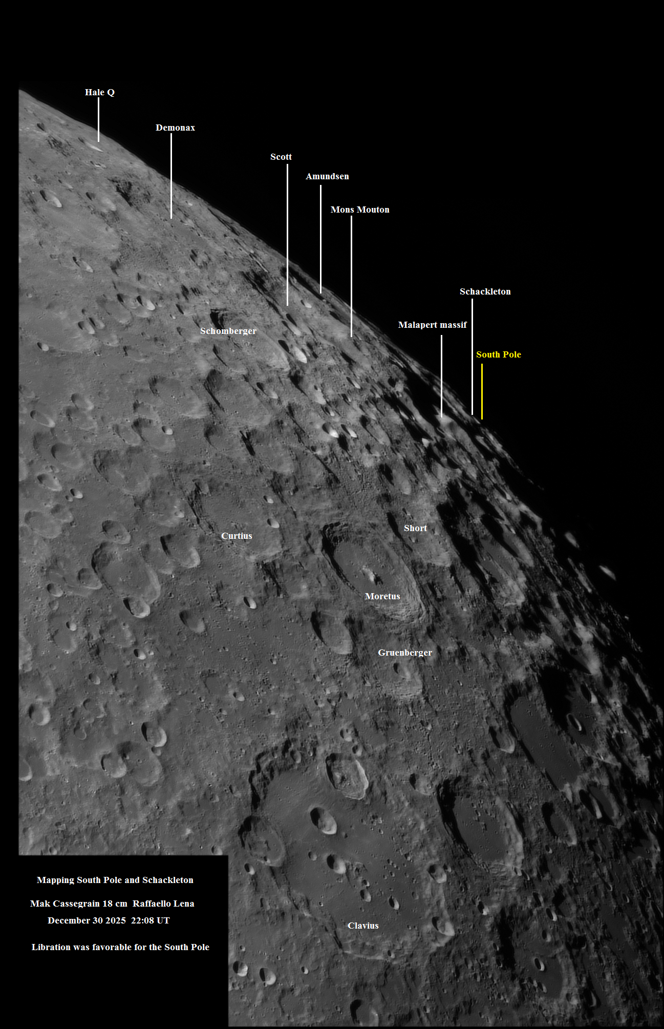
Image Title: Mapping the South Pole of the Moon
Copyright: Raffaello Lena
Date image was taken: December 30, 2025
Location: Rome Italy
Data Acquisition Method: Personal Telescope Setup
Description and Details: Mapping the South Pole during end of current year (2025). On the evening of December 30, 2025, at 22:08 UT, I imaged the southern region of the Moon. Libration was favorable for the South Pole. Interestingly, I have also included the map with labels. Image was taken from Rome Italy, using a Mak Cassegrain 18 cm.
Name: Raffaello Lena
Share & Credit This AAPOD2 Feature
When you share this image on AstroBin, social media, forums, or your own website, please include a credit to AAPOD2 so viewers can discover where this feature came from.
Support AAPOD2 for free! Use Our AGENA ASTRO Affliate Link
AAPOD2 Title: Mapping the Lunar South Pole and Shackleton Crater
AAPOD2 Page Link: https://www.aapod2.com/blog/mapping-the-lunar-south-pole
Submit Your Photo!